I am an interdisciplinary remote senser and geographer with a keen interest in the interface where the physical world interacts with people. I am skilled in using remote sensing methods, and geospatial analysis, which I use to understand and monitor global environmental changes to facilitate sustainable adaptations and management. I also have a passion for stakeholder and public engagement.
Plymouth Marine Laboratory | Jan 2024 - Present
Supervisors: Dr Gemma Kulk, Prof Shubha SathyendranathProjects:
2024 – Present
2025 – Present
University of Southampton | July 2024 - Present
University of Southampton | 2019-2023
Title: “A Spatial and Temporal Assessment of Sargassum Blooms in the Tropical Atlantic”
Supervisors: Prof Emma Tompkins & Prof Jadu Dash- Interdisciplinary PhD (with elements of remote sensing, ecology, oceanography, biology, marine science, GIS, climate change adaptation, hazard management) with the aim of undertaking a cross-scale analysis of sargassum macroalgal blooms and beach landings to better define their spatial and temporal identity and improve management, forecasting and valorisation potential.
- Developed skills in communicating research i.e. completed a systematic review of floating and beach landings of sargassum (published 2020).
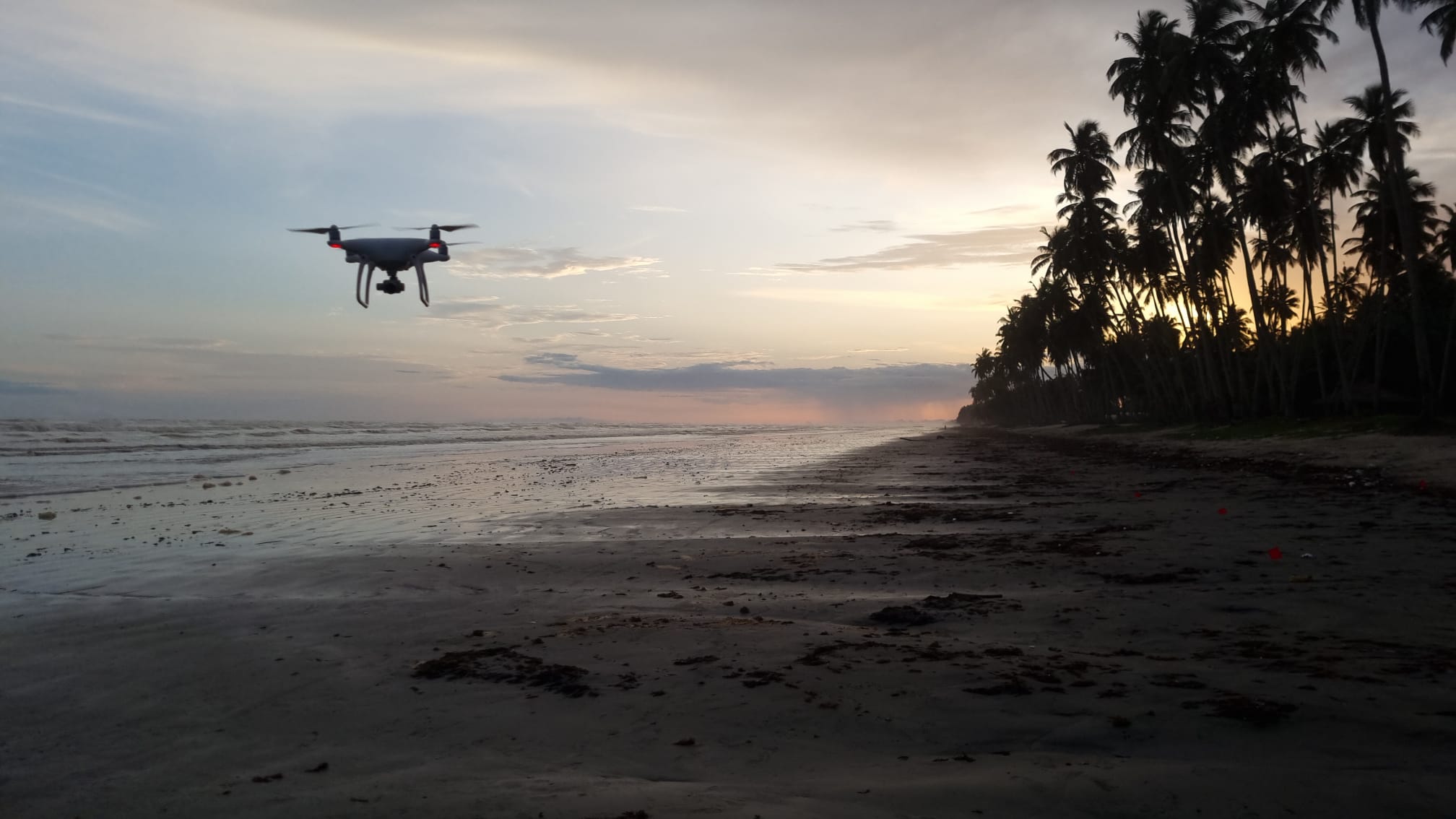
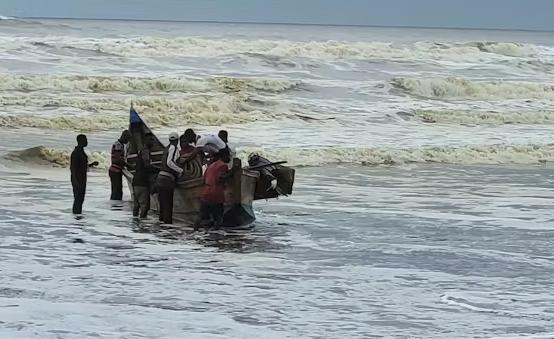
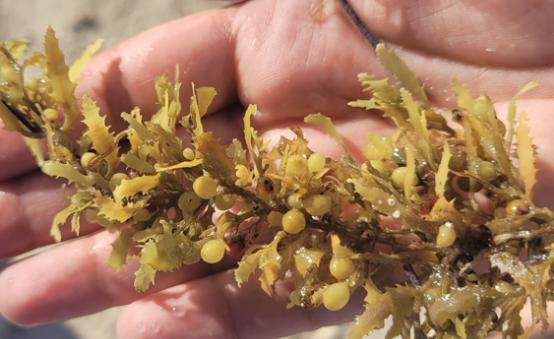
- Devised protocol and undertook fieldwork campaigns to Barbados and Ghana for coastal surveys to collect ground truth data of sargassum macroalgae including use of UASs and a field spectrometer.
- Designed GPS housing and deployed GPS trackers in the ocean to monitor movement of algal blooms in combination with Sentinel-1 and Sentinel-2 imagery.
- Long-term time-series analysis of algal blooms in the Gulf of Guinea using MODIS sensor imagery.
University of Southampton | 2018-2019
- Four-month placement at Snowflake Software (now Cirium).
- Developed competences in analysing spatial data in a variety of software packages including QGIS, ArcGIS, ENVI, CloudCompare, Cyclone, MS Excel, MS Access, Agisoft Metashape, and scripting in Python, R and IDL.
- Distinction award for dissertation “An Investigation into Flight Path Optimisation and their Interaction with Aviation Events".
University of Southampton | 2015-2018
- Physical Geography focus and geospatial and remote sensing skills development including experimental geomorphology, advanced GIS, applied GIS, environmental monitoring.
- First class awarded for dissertation “Mt Merapi: A Volcanic Risk Assessment".
August 2022 – August 2023
Supervisor: Dr Thierry Tonon
Collaboration to bring together remote sensing and biology to investigate valorisation potential of sargassum seaweed.
November 2019 – October 2023
Supervisors: Prof Emma Tompkins & Prof Jadu Dash
Aim: identify new transformational developmental opportunities that build resilience equitably, for the poorest people affected by mass algal blooms of sargassum seaweed in the tropical Atlantic basin.
September 2022 – October 2023
Supervisors: Prof Emma Tompkins, Dr Sien van der Plank, Dr Vicky Dominguez
ESRC Impact Acceleration Award: Building youth-led citizen science expertise in remote Ghanaian coastal communities - SargSnap!
Aim: empowering local communities and young people in Ghana and Mexico to monitor influxes of seaweed on their local beaches through using photography technology, through creating and delivering classroom resources and implementing citizen science.
July 2022 – December 2022
Supervisor: Prof Emma Tompkins
Aim: Building capacity within West African and Central American communities and researchers to monitor, manage and use sargassum to contribute to the circular economy.
August 2021 – March 2022
Supervisor: Prof Bob Marsh
NERC Urgency Grant: Monitoring a large sargassum bloom subject to a major volcanic eruption (MONISARG), in collaboration with University of West Indies and Mona GIS.
Aim: monitor macroalgae blooms in the Caribbean using satellite imagery, drone surveys and in-situ GPS trackers following a volcanic eruption on the island of St. Vincent.
Trustee and Events Committee Coordinator
May 2024 - Present
Committee Member
April 2024 - Present